About native title
Native title refers to the rights and interests relating to land or waters held by Aboriginal people under their traditional laws and customs and recognised by the common law.
Central to native title is having accurate spatial definition for the extent of native title applications lodged with the Federal Court and the Native Title Tribunal. That is where Landgate assists, as WA’s authority on land information.
Our services include:
- native title customised maps
- native title datasets.
See the information below on what these services include or contact us.
Visit Native Title for more information on Western Australian Native Title.
Native title maps
Learn more here about what maps and data Landgate can provide to support native title claims within Western Australia. Some information is subject to a licence agreement.
As part of the whole-of-government approach to native title claim resolution, Landgate creates under instruction from the State Solicitors Office determination maps for Federal Court documentation. Landgate also creates maps for state agreement Indigenous Land Use Agreements (ILUA). Copies of specific determination and ILUA maps can be searched via the Federal Court or the National Native Title Tribunal.
Our mapping services enable customers to request customised native title maps over selected areas of interest. Information can be customised to meet your needs and supplied in hard copy or digital format. Customised information may encompass cadastre, local government boundaries, petroleum and mining interests, topographic information and Aboriginal interests in relation to Native Title Claim boundaries.
Coverage: Western Australia
Currency: various
Format: hard copy and digital
Four datasets are maintained and can be used as map services or downloaded in various formats from Data.wa.gov.au.
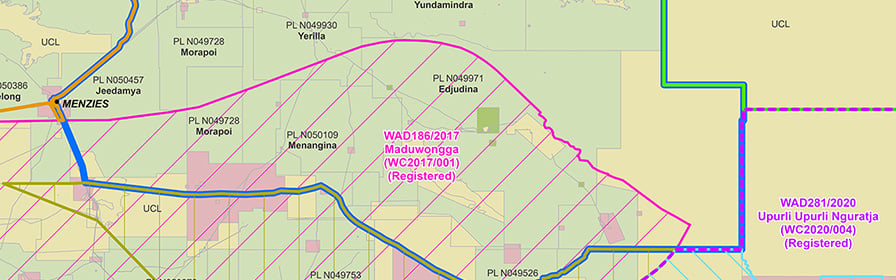
Native Title (Fed Court) (LGATE-005) - This dataset contains the external spatial extent of all Native Title Applications within Western Australia that have been filed/lodged with the Federal Court of Australia. This dataset is a spatial depiction of the first stage of the Native Title process. When a claimant group files an application with the Federal Court to have Native Title determined over their lands, the extent of that boundary is captured in this dataset.
Native Title (NNTT) (LGATE-004) - This dataset contains the external spatial extent of all Native Title Applications within Western Australia that have been registered with the National Native Title Tribunal (NNTT). This dataset is a spatial depiction of the second stage of the Native Title process. NNTT applies a registration test to all filed/lodged applications and if the application passes that test, the application is captured in this dataset.
Native Title (Determination) (LGATE-066) - This dataset contains the external spatial extent of all Native Title Applications within Western Australia that have been determined by the Federal Court of Australia. This dataset is a spatial depiction of the last stage of the Native Title process. When a Determination of Native Title over an Application has been handed down from the Federal Court (by litigation or mediation) the Application is captured in this dataset.
Native Title (ILUA) (LGATE-067) - This dataset contains the external spatial extent of all Indigenous Land Use Agreements (ILUA) within Western Australia, which has been registered or is in notification with the National Native Title Tribunal (NNTT). This dataset is a spatial depiction of ILUAs that can be made outside of the Native Title process but can still be part of a Native Title Determination. When an ILUA is registered or in notification with NNTT the extent of the agreement is captured in this dataset.
Designed to provide easier access to Landgate's cadastral and native title information to stakeholders who deal with native title claims over land in Western Australia.
Landgate SLIP - LOCATE has layers: native title claims registered with the National Native Title Tribunal (NNTT) and the native title claims lodged with the Federal Court.
The data can be interrogated using the native title name, the Federal Court reference number and the NNTT number.
An enquiry on a piece of land can be made, producing the ability to see the claims graphically in relation to each other and to the underlying cadastral parcels is significant for users of Landgate.